GIS Consultant | ICT4MEAL specialist | Researcher & Educator
As a geospatial and MEAL professional, I utilize GIS and location intelligence to develop impactful and cutting-edge technologies that support businesses and strategy in various industries to meet their goals and advance their missions.
My passion for creating a sustainable world drives me to push the boundaries of what's possible with GIS. I strongly believe that this technology has the potential to transform our world and make it a better place. I am dedicated to contributing to this vision and I see a bright future ahead in the use of GIS and location intelligence.
GIS Consultant | ICT4MEAL Specialist | Research | Educator

Almost complete - my research is focued on Leveraging Remote Sensing for Disease Vector Mapping to Enhance Malaria Control Strategies in Zimbabwe
My research focused on building an Integrated Medical Sample Transportation System using GIS to improve coordination of sample movement from collection to time of delivery increasing TAT and effectiveness of the sample Transportation and coordination network
I build and implement innovative MEAL systems from data collection to analysis and reporting through automated workflows
My background in #GIS blends this to establish a robust and Geospatial driven MEAL system
Read MoreIntegrating GIS technology and innovation to support philanthropic work in the Monitoring, Evaluation & Learning Department
Delivering lectures and exploring research inline with geospatial technology and/for sustainable development
Helping businesses, students and individuals unlock their potential and hidden pattersn through geospatial technology
Building and developing projects inline with the Sustainable Development Goals (SDGS) with a focus on Global Health issues.
Supported research staff with Geo-Analytics, Cloud Database deployment and management and the building of location intelligent algorithms to support research efforts
Provided location impact based and innovative solutions to the nation in the fight towards the Coronavirus pandemic

Developing cutting-edge GIS solutions tailored to your specific needs.

Creating custom GIS maps that bring your data to life and drive insights for your business.

Building digital solutions that drive growth and deliver impact

Turning data into insights and opportunities - Uncover the story behind your data with our expert analysis and visualization services.

Empowering organizations to reach their full potential - Drive success with our personalized academic, business, and consulting services.

Providing hands-on training and ongoing support to help you maximize the value of your GIS investment.
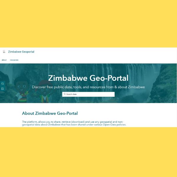
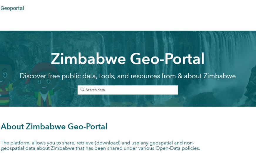
The Zimbabwe Geo-Portal is an initiative to promote the sharing, collaboration and building of open data policies around and within Zimbabwe. The platform provides citizen, organization, government and privately sourced data and information about Zimbabwe all of which comes from various sources and have been authorized for sharing with the public.
The least-cost path is a method that can be used to determine the most optimum route between points based on your needs. This tutorial will help you do the trick.
This short piece is a real-life situation and experience of how I messed up the COVID-19 Database and fixed it all with Python.
Meetings are an important aspect when it comes to planning, teamwork, and collaboration. Thanks to the pandemic, the world has adopted technology more than the usual uptake in the last five years.